I told (begged) Mia on Tuesday that on Saturday we were going to keep driving east until the rain stopped! The forecast for the PDX metro area was for more of the same….RAIN. A co-worker told me that we have received almost a year’s worth of rain in the past 4-5 months. Needless to say the cabin fever is at an all time high right now!
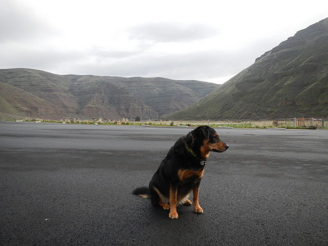
It took us just about 90 miles to get out of the rain. From The Dalles and east things were pretty decent. Temps in the upper 50’s to low 60’s and a mostly cloudy sky. It wasn’t raining though! We were headed to Cottonwood Canyon State Park. The newest park in the Oregon Parks system. There are two trails along the John Day of roughly 4.5 miles each. It’s not arduous hiking and for the most part the trail is very flat. It’s a great place to spend a late winter day though since things tend to be drier on the east side of the cascades. It would be Codi’s first hike of 2017 and also the first one since my birthday hike.
Parking lot was PACKED! (not really)It’s a good 140 miles from Hillsboro to CCSP. We did not leave super early but were on the road before 8AM for the trek. Traffic wasn’t bad at all and mostly non-existent after Hood River.
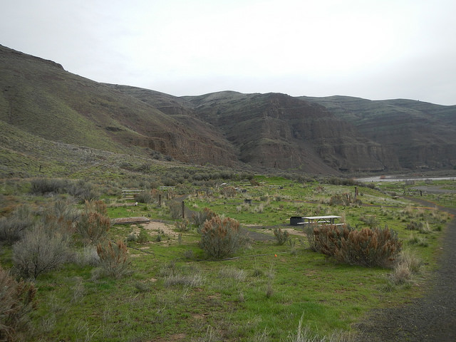
A bit gray still but comfortably warmThere were only two campers at the campground when we arrived. We parked in the day use area though since we would not be spending the night. On our return to the car there were probably half a dozen campsites taken though.
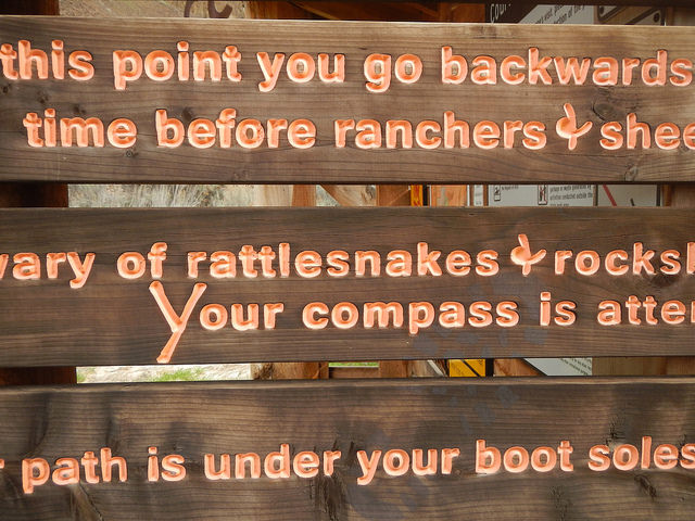
Hiker biker camping areaall the park signs have some additional flair to themI am not sure what the future plans for the park entail. I don’t know exactly where you would be hiking from to get here and the biking on route 206 could be less than ideal given the lack of shoulder and high speed limit. Still, it is nice to see the park system building stuff like this.
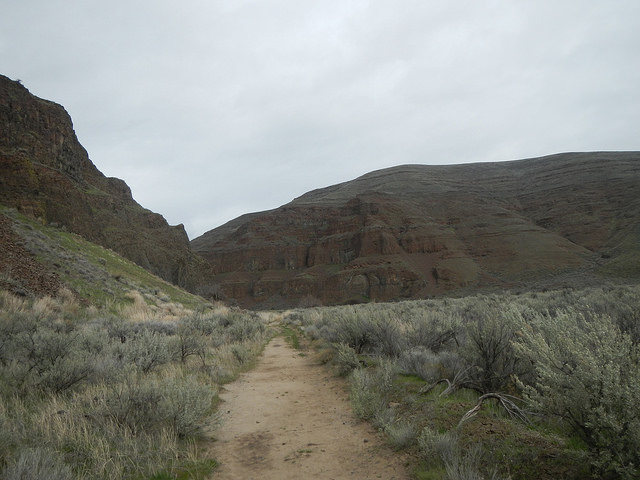
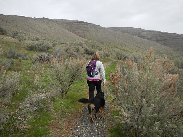
Pinnacles TrailheadWe opted for the north side trail since it is hiker/biker only. The south side trail allows those two and horses too. Codi isn’t the biggest fan of horses and we had no idea how many trail users there would be (not a lot). We saw 8 other hikers all day.
No rattlesnake or goat sightings todayJust like when Dean and I did the successful, and less so, attempts at the Oregon Stampede route, this area is covered in sage brush. The smell of it permeates the air and to my mind (and nose) is quite pleasant.
canyon wall to the left, John Day River to the rightwalled in by sage brushpretty straight forward hikeIt is near impossible to get lost on this hike, and if for some reason you did I would have to assume in general it is not safe for you to leave your house on most days. What I would caution against is that there are rattlesnakes, wild goats, and we saw some pretty large cougar tracks in the mud. Luckily they were not fresh, but that feline had some big mitts.
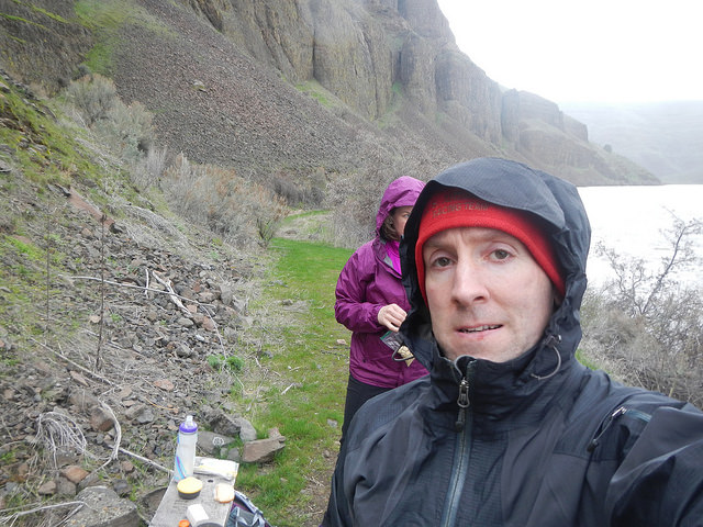
Damn rain followed us!We stopped for a quick lunch at the 4 mile marker after turning around after about 5 miles of hiking. It started to spit rain, then quickly became large cold drops. I wouldn’t classify it has a heavy rain, but it was a hard and cold drizzle for about 15 minutes.
oatmeal!
snow peak stove
I’m really digging the snow peak stove and titanium “pot” (large cup really) for hikes like this. I can heat up something quick and they are both super portable. Probably won’t do too many day hikes without it.
We did not dilly dally on the way out. What took us almost 1:50 hiking in took only about 1:25 hiking out. Mostly because we kept stopping to take pictures on the way in. On the way out, you’ve kind of already seen it all.
my favorite hiking crewSince the park used to be a ranch there are still some remnants of those days. A big barn, the cattle pens and some farm equipment. There is a visitors center too, but it was all locked up on this day. I assume as summer hits things start to get a bit busier around here.
Barn
Visitors Center
Mooooo
Cow corral
Nice weather today!
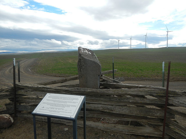
On the way back towards I-84 and The Dalles we took a little side trip to one of the Lewis & Clark monuments. I had noticed it on the map and curiosity got the better of me. So we drove along the ridge and past dozens of windmills to a random corner in a gravel road. It was a bit underwhelming but still kind of neat.
Lewis & Clark monument in the middle of nowhereLast side trip I had Mia indulge me with was to take her out to Dufur and show her Kramer’s Market. We had a late lunch/early dinner of sandwiches from the deli counter. I don’t think Mia was quite as smitten with it as Dean and I are….however she has yet to experience the 40+ miles of gravel riding to get there from Deschutes River State Park. Hopefully one day I can convince her to give it a shot.
It was a full day. We left the house before 8AM and got home a little past 7:30. Got in a 10 mile hike, a little Oregon Trail action and a side trip to a tiny town. Great way to spend the day and very much appreciated the chance to get the heck out of the rain for a bit!
I actually biked through on 206 on my roundabout way to Boise a few years ago. At the time, I think they must have just opened the state park–at least, it wasn’t on my map, and I was pretty surprised to see biking infrastructure in what to me felt like the middle of nowhere. 206 wasn’t bad biking though! No real shoulder, like you said, but no real traffic either;) (also, no real shade–that was the hardest part in September!!)


I actually biked through on 206 on my roundabout way to Boise a few years ago. At the time, I think they must have just opened the state park–at least, it wasn’t on my map, and I was pretty surprised to see biking infrastructure in what to me felt like the middle of nowhere. 206 wasn’t bad biking though! No real shoulder, like you said, but no real traffic either;) (also, no real shade–that was the hardest part in September!!)