I’ve got a hashtag that I use on Instagram #Oregonisnotpdx. I like to toss it on things that I believe show the real Oregon and not the cliché idea that Oregon is only PDX, hipsters, craft beer and coffee shops. While the majority of the population lives along the I-5 corridor in the Willamette Valley to me the True Oregon is all of the far flung places and small communities.


Dean and I last rode the Stampede in 2016 under pretty spectacular weather conditions but we made the huge mistake of starting way too late in the morning and getting back to camp around 11pm. This time I invited Dean, Carl and then posted on the Unpaved google group as an open invite. My plan was to be rolling by 7:30AM in order to avoid any darkness issues.
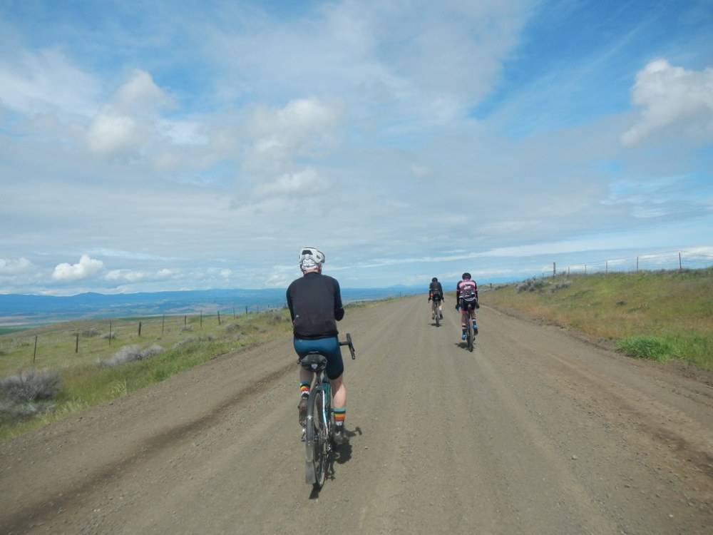
I believe 8 of us rolled out of the Lower Deschutes Campground about 7:45ish with most people sounding like they were opting for a 70 mile option versus the full 125 mile loop. Weather forecast for the afternoon was iffy so I can see why people didn’t want to get stuck in foul weather far from anything.
Carl and I planned on doing the full route knowing Dean was doing the 70 mile option and could always come pick us up if things went sideways.

We had picture perfect weather at the start of the day. Temps were supposed to be low 70’s with scattered showers coming in around 5pm. For the first 70 miles Carl and I pretty much enjoyed light winds and blue sky. That would change quite a bit after the Sherar’s Bridge climb.
Everyone but Carl and I headed back to camp after a stop at Kramer’s Market in Dufur. The two of us continued the full loop after making sure Dean was all set. This part of the route was the one I as having the hardest time remembering. Friend, Oregon and the White River Wildlife Area stand out but between Dufur and Friend was a bit of a blank. I remember now because you’re mostly riding along nice gravel roads and all the land on either side is owned by one or two ranchers. There are more trees and scrub brush in this 30 mile section too. It has the full on high dessert/central Oregon feel compared to the open fields and rolling hills of the first 40 miles.


The Tygh Valley Store comes right around mile 68. This means you’ve got just about 57 miles to go with pretty much no services on route. There is an option in Grass Valley but it requires a very slight detour to hit up.
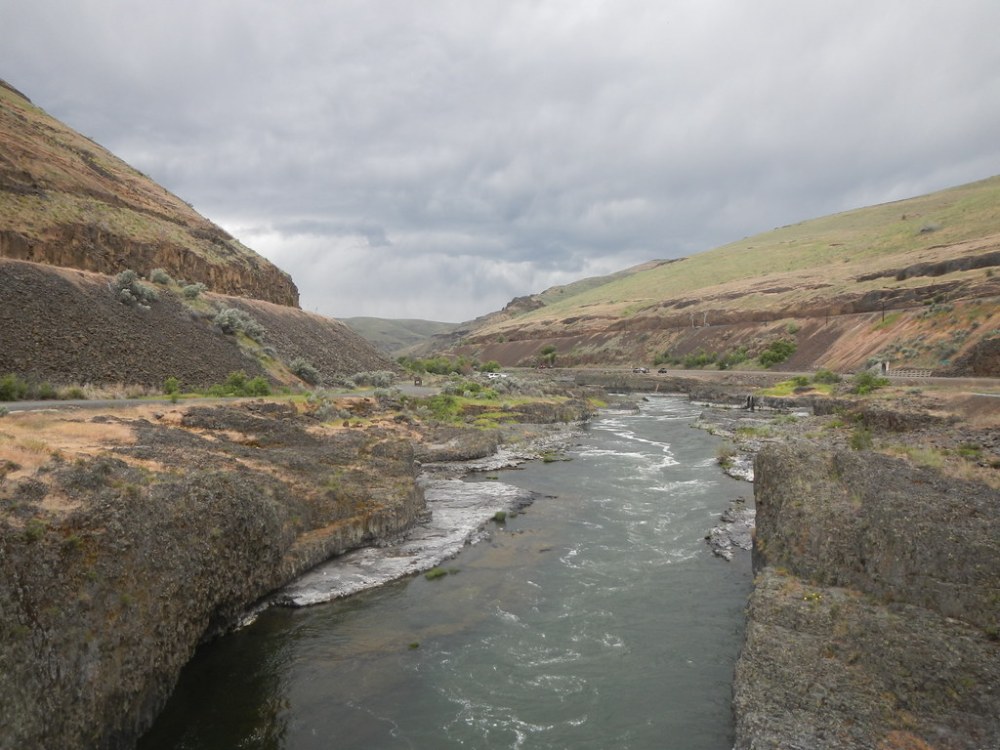
The next few miles are some of the more boring on the route between Tygh Valley Store and Sherar’s Bridge. It’s all pavement and little rollers until you drop down to the bridge and are then faced with a heck of a climb back up to the top of the plateau. This happens to also be the point when Carl and I could see some weather coming in from the west. It was definitely raining and the winds were whipping around decently too.

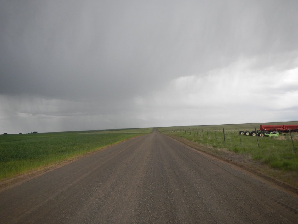
The first couple drops started to hit us about 1/4 mile from the top of the climb. They were big and cold rain drops and we took no time in pulling over and tossing on rain gear and warmer clothes. The temps had dropped about 15-16 degrees since Tygh Valley Store too.
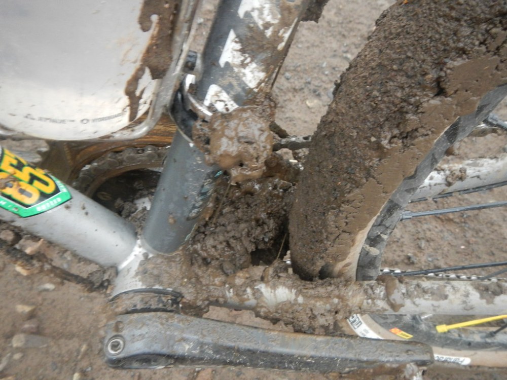
Right around mile 100 there is this section that Dean and I referred to as moon dust when we rode it in 2016. Then as our tires rolled over it there was this almost Styrofoam squeaky sound. Well this time around, with recent rain showers passing through, that moon dust turned into sticky peanut butter mud that stuck to everything. Carl’s fenders were getting jammed up with the stuff and even my Panaracer Gravel Kings (slick version) were getting gunked up with it. This required several stops, scraping off mud with sticks from the side of the road and even walking along the edges of the road for a while since we couldn’t ride the gravel/mud without everything clogging up. Last thing either of us needed was to rip a derailleur off or break a chain.
This slowed us down quite a bit. We had been on track to get back a little before 8pm, now it was looking more like 8:30. Luckily this mud didn’t last long and with about 12 miles to go Dean pulled up in Bonnie just to make sure we were both okay. Carl had his phone on airplane mode and I had turned mine off to conserve battery, so neither of us saw the text from Dean earlier as the rain rolled into the campsite. He wanted to make sure we were okay.
I did take this opportunity to put on a dry wool jersey and a much better rain jacket than the one I had on me. It was mostly downhill all the way back to the campsite and I think I would have been fine with what I had, even though I was soaked all the way through. Putting on a warm top and better jacket was pretty damn sweet though.
We rolled into camp close to 8:30 or so after an elapsed time of 12:38 total hours since leaving and a moving time of 9:57. I had a goal of taking it at a “sane” pace and not killing it early. I think we did a decent job and could have probably shaved 10-15 minutes off the moving time if it hadn’t been for the walking muddy section.
I have to thank Dean for Saturday dinner and breakfast the next morning plus the delivery of dry clothes in the middle of nowhere. It was greatly appreciated. I can’t forget the Friday night milkshake either!
I also have to thank Carl for sticking it out with me on the full route. It would have been so boring to ride that last 40 miles by myself after the long climb. The chocolate covered espresso beans were spot on!
Thanks to the folks who came out for the first part out to Dufur too. Always fun to meet new riders or acquaint a real face/name with a cyber identity.

Thanks for reading,
-Pete

I love this so much! Eastern Oregon is the treasure and PDX gets all the credit haha. The deschutes and metolious have always been my favorite spots. It was fun to see your pictures, Oregon really does have the best camping and biking trails.